Soil survey
Contents |
[edit] Introduction
Soil is one of the most important natural resources and performs many important functions for plants, animals and humans. Construction activities can have an adverse effect on soils and so its impacts need careful consideration as part of the development process.
A soil survey is a detailed study of the characteristics of soil within an area. A soil survey will:
- Classify the soil according to a standard classification system.
- Record the boundaries of soils on a map.
- Provide predictions about how soils will behave.
Soil surveys can help inform the appropriate use of land, inform development proposals and predict the impacts of land use on the environment.
[edit] Method
A soil survey should be undertaken by a suitably qualified and experienced soil scientist before any earthworks begin. The survey will provide the appropriate information to determine and quantify the extent of topsoils and subsoils on a site.
Typically, a survey will involve the use of hand-held sampling equipment such as hand augers, and for some investigations, trial pits may be required. Repeated soil samples are taken around the site with the characteristics of each layer recorded (for example; colour, texture, drainage details, topsoil/subsoil). Analysis of representative soil samples will also be undertaken to characterise different soil material; for example, pH, particle size, organic matter, potential contaminants, and so on.
[edit] Soil classification
A number of different soil classification systems are available, which differentiate between the numerous soil types found around the world. The Soil classification system of England and Wales is based on the differences in the soil profile, that is, ‘…a sample of the soil mantle extending from the ground surface to about 1.5 m, and formed of several layers or soil horizons’.
[edit] Reporting
A detailed report should be produced following the survey which includes:
- A description of the characteristics of each soil resource.
- A discussion of the potential for re-use of soils on site.
- Recommendations for the handling and storage of soils on site.
- Maps showing the locations of soils on site.
The results should generally be incorporated into a Material Management Plan or Site Waste Management Plan.
[edit] Soils Action Plan for England
In 2009, the Department for Environment, Food & Rural Affairs (DEFRA) published Safeguarding our Soils which sets out the government’s vision for the sustainable management of soils to 2030.
[edit] Planning
The National Planning Policy Framework outlines how valued soils should be protected and enhanced, with the prevention of unacceptable levels of pollution.
[edit] Soil protection during construction
During construction there is the potential for long-term negative impacts on soils and as a result, DEFRA has published a Code of Practice for the sustainable use of soil on construction sites.
[edit] Related articles on Designing Buildings Wiki
- Alluvium.
- Bedrock.
- Building on fill.
- Building survey.
- Conceptual site model.
- Condition survey.
- Contaminated land.
- Desk study.
- Geophysical survey.
- Ground conditions.
- Ground investigation.
- Insitu testing of soils.
- Land surveying.
- Minerals surveyor.
- Radon.
- Sinkholes.
- Site investigation.
- Site survey.
- Subsoil.
- The importance of soil analysis.
- Topsoil.
- Trial pit.
- Types of soil.
- Vendor survey.
[edit] External references
Featured articles and news
Homes England creates largest housing-led site in the North
Successful, 34 hectare land acquisition with the residential allocation now completed.
Scottish apprenticeship training proposals
General support although better accountability and transparency is sought.
The history of building regulations
A story of belated action in response to crisis.
Moisture, fire safety and emerging trends in living walls
How wet is your wall?
Current policy explained and newly published consultation by the UK and Welsh Governments.
British architecture 1919–39. Book review.
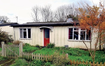
Conservation of listed prefabs in Moseley.
Energy industry calls for urgent reform.
Heritage staff wellbeing at work survey.
A five minute introduction.
50th Golden anniversary ECA Edmundson apprentice award
Showcasing the very best electrotechnical and engineering services for half a century.
Welsh government consults on HRBs and reg changes
Seeking feedback on a new regulatory regime and a broad range of issues.
CIOB Client Guide (2nd edition) March 2025
Free download covering statutory dutyholder roles under the Building Safety Act and much more.
Minister quizzed, as responsibility transfers to MHCLG and BSR publishes new building control guidance.
UK environmental regulations reform 2025
Amid wider new approaches to ensure regulators and regulation support growth.
BSRIA Statutory Compliance Inspection Checklist
BG80/2025 now significantly updated to include requirements related to important changes in legislation.


