


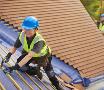
Site surveys
Site surveys are detailed studies carried out to supplement and verify site information provided by the client and site appraisals carried out by the consultant team.
They may begin with a simple walkover survey and then progress to more detailed surveys focusing on specific issues.
Site surveys might be carried out by members of the consultant team if they have the required skills, or might be commissioned from specialists. The consultant team should assess what surveys are required (generally after initial feasibility studies have been carried out), and request approval from the client to commission those surveys or carry them out themselves.
Site surveys might include:
- Existing buildings (including valuation, measured surveys, structural surveys, structural investigations, condition surveys, and demolition surveys).
- Geological and geotechnical.
- Topographical surveys, perhaps including laser scanning, Lidar or photogrammetry.
- Contamination.
- Ecological survey.
- Archaeological (see Archaeology).
- Traffic and transport.
- Local climate.
- Flood risk.
- Air quality.
- Acoustic.
- Photographic.
- Historic use.
- Boundary surveys.
- Structural surveys (including retained structures, underground structures and obstructions).
- Unexploded bomb survey.
- Railway and tunnel search.
- Asbestos and other hazardous materials surveys and registers.
- Fire hydrants.
- Telecommunications.
- Wireless networks and satellite reception.
- Electrical infrastructure and capacity.
- Gas network infrastructure and capacity.
- Foul sewers and drains infrastructure and capacity.
- Existing water supply infrastructure and capacity.
- Soil survey.
Wherever possible, any information prepared or obtained should be in a format which can be readily shared and used, and should be stored and named in a way consistent with the long-term project and operational needs.
[edit] Related articles on Designing Buildings
- 3D laser survey.
- Archaeology and construction.
- Building People.
- Building survey.
- Condition survey.
- Desk study.
- Development appraisal.
- Easements.
- Ecological survey.
- Environmental Impact Assessment.
- EWS1 forms not required for buildings without cladding.
- Ground conditions.
- Ground investigation.
- Interferometric synthetic aperture radar InSAR.
- Interview with Elly Ball, co-founder, Get Kids into Survey.
- Land surveying.
- Laser scanning.
- Levelling.
- Measurement of existing buildings.
- Pre-construction information.
- RICS publishes Land Measurement for Planning and Development Purposes.
- Site appraisals.
- Soil survey.
- Surveying instruments.
- Surveyor.
- Technical due diligence.
- Vendor survey.
- Walkover survey.
- What is a valuer?
Featured articles and news
Costs and insolvencies mount for SMEs, despite growth
Construction sector under insolvency and wage bill pressure in part linked to National Insurance, says report.
The place for vitrified clay pipes in modern infrastructure
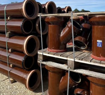
Why vitrified clay pipes are reclaiming their role in built projects.
Research by construction PR consultancy LMC published.
Roles and responsibilities of domestic clients

ACA Safety in Construction guide for domestic clients.
Fire door compliance in UK commercial buildings
![]()
Architect and manufacturer gives their low down.
Plumbing and heating for sustainability in new properties

Technical Engineer runs through changes in regulations, innovations in materials, and product systems.
Awareness of the Carbon Border Adjustment Mechanism
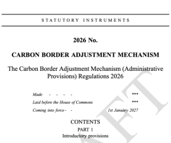
What CBAM is and what to do about it.
The new towns and strategic environmental assessments
12 locations of the New Towns Taskforce reduced to 7 within the new towns draft programme and open consultation.
Buildings that changed the future of architecture. Book review.
The Sustainability Pathfinder© Handbook
Built environment agency launches free Pathfinder© tool to help businesses progress sustainability strategies.
Government outcome to the late payment consultation, ECA reacts.
IHBC 2025 Gus Astley Student Award winners
![]()
Work on the role of hewing in UK historic conservation a win for Jack Parker of Oxford Brookes University.
Future Homes Building Standards and plug-in solar
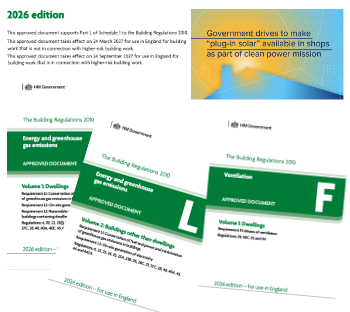
Parts F and L amendments, the availability of solar panels and industry responses.
How later living housing can help solve the housing crisis

Unlocking homes, unlocking lives.
Preparing safety case reports for HRBs under the BSA
A new practical guide to preparing structural inputs for safety cases and safety case reports published by IStructE.
Male construction workers and prostate cancer

CIOB and Prostate Cancer UK encourage awareness of prostate cancer risks, and what to do about it.