


Surveying instruments
Contents |
[edit] Introduction
Surveying is the process and technique of determining distances and angles between points, used on construction sites for the purposes of levelling and setting out works.
Surveying relies for its accuracy and efficiency on having the right instruments. Surveyors use a range of instruments for land surveying and mapping, and setting out.
Historically, surveying equipment might have included:
- Chains with equal size links to measure distance between two points.
- Compasses to measure the direction of a line.
- Solar compasses to measure the direction and latitude of a particular point using the sun and stars.
- Dioptra to measure angles.
- Measuring wheels to measure large distances.
Modern surveying equipment might include:
[edit] Theodolite

Theodolites were developed to measure precise horizontal and vertical angles for the purpose of triangulation – determining the location and distance of a point through the formation of triangles.
In its simplest form, a theodolite consists of a moveable telescope attached over perpendicular axis. It is mounted on a tripod head by means of a tribarch containing thumbscrews for tightening and loosening. The theodolite should be placed vertically above the point to be measured using a plumb bob or laser plummet. Tubular spirit bubbles are used to keep the instrument level.
A ‘transit’ is a type of theodolite developed in the early-19th century by railroad engineers. As well as being able to turn horizontally, a transit has a vertical circle and a telescope that can be inverted in the vertical plane.
Modern theodolites use an electronic rotary encoder to read the horizontal and vertical circles to great levels of precision.
A gyro-theodolite comprises a gyroscope mounted to a theodolite and is used, predominantly in mine surveying and tunnel engineering, to determine the orientation of true north. Gyro-theodolites were used during the construction of the Channel Tunnel to align the two tunnels as they were constructed from both France and the UK.
A tachymeter (or tacheometer) is a type of theodolite used for rapid measurements. Similar to a rangefinder, it can determine electronically or electro-optically, the distance to a target.
[edit] Measuring wheel

Surveyors use measuring wheels for quicker and lower accuracy surveys of long distances by rolling it from the start to end point. Each revolution of the wheel measures a specific distance, such as a yard or metre. Counting revolutions with a mechanical device attached to the wheel measures the distance directly.
[edit] Dumpy level

A dumpy level consists of a telescope-like device fitted on a tripod stand and used for establishing or verifying points in the same horizontal plane. Together with a vertical staff, it is used to measure height differences and transfer elevations during building surveys.
Variants include:
- Tilting level: The telescope can be flipped through 180-degrees.
- Auto level or self-levelling level: Includes an internal compensator mechanism which automatically removes any variation when set close to level. This has the advantage of ease-of-use and can be set up quickly.
- Digital electronic level: This uses electronic laser methods to read a bar-coded vertical staff.
[edit] Tripod
Most surveying instruments are fixed on a tripod, which acts as a support. Tripods have three legs which can be extended or lowered as required.
[edit] Total station

A total station (sometimes referred to as a Total Station Theodolite TST) is a modern theodolite which is a transit fitted with an electronic distance meter (EDM).
A microprocessor unit in the total station processes the data collected to determine:
- The average of multiple angles measured.
- The average of multiple distance measured.
- The horizontal distance.
- The distance between any two points.
- The elevation of objects.
- All three coordinates of the observed points.
The data that is collected and processed can be downloaded for further processing by computer aided design (CAD), building information modelling (BIM) or geographic information system (GIS) software.
These are now the most commonly used surveying instrument due to their precision and accuracy. Total stations also enable field work to be carried out rapidly with quick calculations of coordinates.
[edit] Related articles on Designing Buildings
- Building survey.
- Condition survey.
- Construction tools.
- Geophysical survey.
- Global positioning systems and global navigation satellite systems.
- How to layout a building.
- Interview with David Southam about laser scanning in construction.
- Land surveying.
- Laser scanning.
- Level.
- Levelling.
- Plumb level.
- Real time kinematic RTK.
- Robotic total station.
- Site surveys.
- Surveyor.
- Tool and equipment care and maintenance.
Featured articles and news
Costs and insolvencies mount for SMEs, despite growth

Construction sector under insolvency and wage bill pressure in part linked to National Insurance, says report.
The place for vitrified clay pipes in modern infrastructure
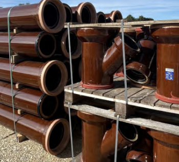
Why vitrified clay pipes are reclaiming their role in built projects.

Research by construction PR consultancy LMC published.
Roles and responsibilities of domestic clients

ACA Safety in Construction guide for domestic clients.
Fire door compliance in UK commercial buildings
![]()
Architect and manufacturer gives their low down.
Plumbing and heating for sustainability in new properties

Technical Engineer runs through changes in regulations, innovations in materials, and product systems.
Awareness of the Carbon Border Adjustment Mechanism
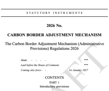
What CBAM is and what to do about it.
The new towns and strategic environmental assessments
12 locations of the New Towns Taskforce reduced to 7 within the new towns draft programme and open consultation.

Buildings that changed the future of architecture. Book review.
The Sustainability Pathfinder© Handbook
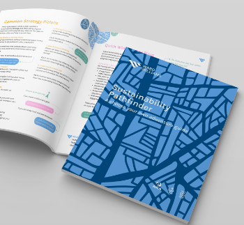
Built environment agency launches free Pathfinder© tool to help businesses progress sustainability strategies.

Government outcome to the late payment consultation, ECA reacts.
IHBC 2025 Gus Astley Student Award winners
![]()
Work on the role of hewing in UK historic conservation a win for Jack Parker of Oxford Brookes University.
Future Homes Building Standards and plug-in solar

Parts F and L amendments, the availability of solar panels and industry responses.
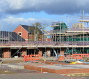
How later living housing can help solve the housing crisis

Unlocking homes, unlocking lives.
Preparing safety case reports for HRBs under the BSA

A new practical guide to preparing structural inputs for safety cases and safety case reports published by IStructE.
Male construction workers and prostate cancer

CIOB and Prostate Cancer UK encourage awareness of prostate cancer risks, and what to do about it.
Comments