


Datum
On a construction project, a datum level is an arbitrary horizontal plane of reference from which all vertical dimensions are measured. It can show the vertical height difference between floor levels of a building as well as differences in levels between one part of the site and another.
The datum on a site can be given a 0.000m designation but this does not have to necessarily be outside ground level; if it is, a ground floor may be at say, 0.750m and a first floor at 4.750 and so on proceeding up the building. In contrast, a basement which will be below ground will be below datum level and will therefore have a minus symbol prefixed to it e.g -3.250m.
However, minus signs can be easily misread, not seen or read as a dash, so can cause confusion. For this reason, a suitable fixed point (called a temporary benchmark – TBM) is assumed to ensure that all other levels are positive. So, in the case of the basement level referred to above, it may be given 0.000m as the site datum, in which case (following the logic from above) ground level = 3.250m; ground floor = 4.000m; first floor = 8.000m and so on. The levels usually refer to finished floor levels (FFL) but can also indicate other features e.g finished structural level (FSL)
Datum levels are useful as they provide points of reference to allow the vertical setting out of buildings and how they relate to other levels on a site. They should be clearly indicated on all relevant drawings with all levels described in metres to three decimal places but always as positive numbers because they are above datum level.
It is increasingly the case, especially for large projects, that the Ordnance Survey (OS) datum is used as a project datum as it allows work on the site to be related to other features in the area, e.g manholes and sewers, local gradients etc. Using this approach means that everything is to the same OS datum and OS grid (OSG).
Note: OS datum is taken as height above sea-level based on a known datum point at Newlyn, Cornwall; if the OS datum is being used, it must be indicated on the drawings. OSG is the standard known grid across the UK.
For more information see: Ordnance datum.
[edit] Other datums
A datum may also be a line from which all other horizontal dimensions relate to whether, on architectural or engineering drawings. An example is a building that has a plan generated from a back wall.
A datum may also be a point that is used for setting out the building. This must be clearly marked on drawings to help the contractor’s setting out. For example, a circular building will be set out from a datum point from which all radii are generated.
Drawing for Understanding, Creating Interpretive Drawings of Historic Buildings, published by Historic England in 2016 defines a datum line as: 'A horizontal or vertical reference line used to control height and horizontal distance measurements.'
The Geospatial Glossary, published by the Geospatial Commission, and accessed on 17 September 2022, defines horizontal datums as: ‘…a series of data points on the surface of the earth that are used to measure the position of oneself on the Earth’s surface.’
[edit] Related articles on Designing Buildings
- At grade.
- Data.
- Ordnance Survey.
- Origin point.
- Geographic information system GIS.
- Global positioning systems and global navigation satellite systems.
- Building height.
- International Property Measurement Standards.
- Invert.
- Location plan.
- Measurement.
- Ordnance datum.
- Setting out.
- Site plan.
- Water engineering.
Featured articles and news
Costs and insolvencies mount for SMEs, despite growth

Construction sector under insolvency and wage bill pressure in part linked to National Insurance, says report.
The place for vitrified clay pipes in modern infrastructure
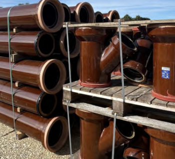
Why vitrified clay pipes are reclaiming their role in built projects.

Research by construction PR consultancy LMC published.
Roles and responsibilities of domestic clients

ACA Safety in Construction guide for domestic clients.
Fire door compliance in UK commercial buildings
![]()
Architect and manufacturer gives their low down.
Plumbing and heating for sustainability in new properties

Technical Engineer runs through changes in regulations, innovations in materials, and product systems.
Awareness of the Carbon Border Adjustment Mechanism
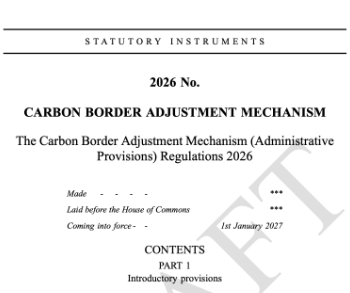
What CBAM is and what to do about it.
The new towns and strategic environmental assessments
12 locations of the New Towns Taskforce reduced to 7 within the new towns draft programme and open consultation.
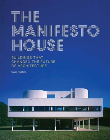
Buildings that changed the future of architecture. Book review.
The Sustainability Pathfinder© Handbook
Built environment agency launches free Pathfinder© tool to help businesses progress sustainability strategies.

Government outcome to the late payment consultation, ECA reacts.
IHBC 2025 Gus Astley Student Award winners
![]()
Work on the role of hewing in UK historic conservation a win for Jack Parker of Oxford Brookes University.
Future Homes Building Standards and plug-in solar

Parts F and L amendments, the availability of solar panels and industry responses.
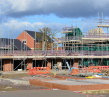
How later living housing can help solve the housing crisis

Unlocking homes, unlocking lives.
Preparing safety case reports for HRBs under the BSA
A new practical guide to preparing structural inputs for safety cases and safety case reports published by IStructE.
Male construction workers and prostate cancer

CIOB and Prostate Cancer UK encourage awareness of prostate cancer risks, and what to do about it.
Comments