Floor level (FL)
Contents |
[edit] Floor Level
Floor level is a general, informal term to describe the Finished Floor Level (FFL) of a building, but as it is an informal term it may refer to a bare unfinished floor level also.
[edit] Finished Floor Level (FFL)
Finished floor level (FFL) refers to the uppermost surface of a floor once construction has been completed but before any finishes have been applied. So, in concrete construction it may be the uppermost surface of a screeded finish, or in timber construction, FFL will denote the top level of floorboards, chipboard or ply decking.
Finished floor level does not take into account any applied finishes as these may be added by owners, occupiers or tenants, will vary in thickness, e.g a thick shag-pile carpet has different thickness to a laminated floor, and may be replaced.
[edit] Structural Floor Level (SFL) / Structural Slab Level (SSL)
Structural Floor Level (SFL) or sometimes Structural Slab Level (SSL) in the case of concrete frame buildings, describes the floor level prior to the addition of finishing items such as screed, underlay and flooring. The numerical measure will normally be written next to the abbreviation on a drawing often with a + to indicate vertical increase or - in the case of basements. The figure will be a certain amount above or below whatever the agreed setting out position or datum is. For example the setting out position might be 0.00, the SSL +3.0 and the FFL +3.3.
[edit] Building Ground Level (BGL)
Building Ground Level (BGL) might be used to describe the setting out position for the building ie the 0.00 from which all other levels will be measured. The height of this in relationship to the site itself will depend on the approach taken and agreed by the project team, though it will normally be slightly higher than the Ordinace Survey (OS) Level or Natural Ground Level (NGL) to allow for structural foundations.
[edit] Ordinance Survey (OS) level
Ordinance Survey (OS) level, is based on the accepted levels or measures of the lay of land across the United Kingdom, these are calculated through the use of Ordnance Survey Bench marks (BMs) which are survey marks that are made by Ordnance Survey to record the height of the landscape above Ordnance Datum. Based on these and the process of surveying, the more localised OS or what might be call Natural Ground Levels are calculated and recorded.
[edit] Natural Ground Level ( NGL)
Natural Ground Level ( NGL) is the accepted datum for a site prior to any excavation works to lay the foundations of the building.
[edit] Related articles on Designing Buildings
Featured articles and news
Moisture, fire safety and emerging trends in living walls
How wet is your wall?
Current policy explained and newly published consultation by the UK and Welsh Governments.
British architecture 1919–39. Book review.
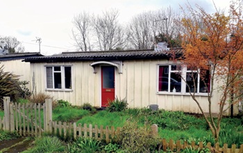
Conservation of listed prefabs in Moseley.
Energy industry calls for urgent reform.
Heritage staff wellbeing at work survey.
A five minute introduction.
50th Golden anniversary ECA Edmundson apprentice award
Showcasing the very best electrotechnical and engineering services for half a century.
Welsh government consults on HRBs and reg changes
Seeking feedback on a new regulatory regime and a broad range of issues.
CIOB Client Guide (2nd edition) March 2025
Free download covering statutory dutyholder roles under the Building Safety Act and much more.
AI and automation in 3D modelling and spatial design
Can almost half of design development tasks be automated?
Minister quizzed, as responsibility transfers to MHCLG and BSR publishes new building control guidance.
UK environmental regulations reform 2025
Amid wider new approaches to ensure regulators and regulation support growth.
The maintenance challenge of tenements.
BSRIA Statutory Compliance Inspection Checklist
BG80/2025 now significantly updated to include requirements related to important changes in legislation.
Shortlist for the 2025 Roofscape Design Awards
Talent and innovation showcase announcement from the trussed rafter industry.


