


Ground control point GCP

Contents |
[edit] Introduction
A ground control point (GCP) is a place or object with a known geographic location (or GPS coordinate) that can be used as a reference point to deliver a precise aerial map for surveying purposes. GCPs are built on the principle of recording the position of an object by calculating the distance and angles between strategically selected points. GPCs can make it possible to map large areas in aerial mapping surveys.
[edit] Parameters for GCPs
GPCs can be photo identifiable objects (such as a manhole cover) or a marked black and white symbol (such as the figure “X” painted on the ground or a small section of a checkerboard). Traditional surveying methods or existing maps can be used to locate the points, but other approaches - such as LiDAR or Google Earth - can also be used.
From an aerial photography perspective, GCPs are a traditional method of defining a location. High contrast colours can be used to make GCPs stand out on drone maps. They should have centrepoints that are clearly defined.
There are other parameters for creating GCPs, including spatial reference systems. These systems are used to relay positions in GCPs by defining several parameters, including:
- Reference ellipsoid. This is the geometric surface that represents the approximate shape of the Earth.
- Reference datum. This is the reference point that is used as the basis for the measurement of all positions.
- Geoid model. This representation of the Earth’s surface uses mean sea level as the reference point of measurement.
- Unit of measurement. This data should be clearly stated - degrees (in latitude and longitude, metres or feet) in relation to how the GCP will be measured in relation to the reference datum.
- Map projection. The method of converting the map from a 3D ellipsoid into a flat plane applies a formula referred to as coordinate transformation.
[edit] Advances in drone surveillance
While GCPs have been a tested method of aerial mapping, there are some inefficiencies associated with the method. There can be logistical challenges when obtaining authorisation for access. In some cases, it may not be possible to gain physical access to the area, even once permission has been granted, due to dangerous terrain or hazardous or remote locations.
In addition, set up can involve a significant amount of time, labour and equipment.
There are several types of equipment that use differential correction technology to provide better data location information; this essentially removes the need for GCP set up. The most commonly used options are real time kinematic (RTK) and post processed kinematic (PPK). RTK makes real time corrections to images captured by GPS while PTK corrects location data after it has been collected and uploaded. In some instances, it can be helpful to use GCPs to enhance information gathered by RTK or PPK enabled technologies, particularly in instances where it is important to capture certain types of precise data regarding accuracy of scale, orientation and so on.
[edit] Related articles on Designing Buildings
- Construction drones.
- Global positioning systems and global navigation satellite systems.
- Ground sample distance GSD.
- Interview with Elly Ball, co-founder Get Kids into Survey.
- Land surveying.
- Laser scanning for building design and construction.
- Post processed kinematic PPK.
- Real time kinematic RTK.
- Universal transverse mercator projection.
- Uses of drones in construction.
Featured articles and news
ECA progress on Welsh Recharging Electrical Skills Charter

Working hard to make progress on the ‘asks’ of the Recharging Electrical Skills Charter at the Senedd in Wales.
A brief history from 1890s to 2020s.
CIOB and CORBON combine forces

To elevate professional standards in Nigeria’s construction industry.
Amendment to the GB Energy Bill welcomed by ECA

Move prevents nationally-owned energy company from investing in solar panels produced by modern slavery.

Gregor Harvie argues that AI is state-sanctioned theft of IP.

Heat pumps, vehicle chargers and heating appliances must be sold with smart functionality.
Experimental AI housing target help for councils

Experimental AI could help councils meet housing targets by digitising records.
New-style degrees set for reformed ARB accreditation
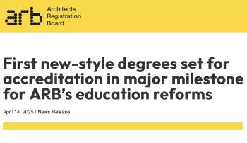
Following the ARB Tomorrow's Architects competency outcomes for Architects.
BSRIA Occupant Wellbeing survey BOW
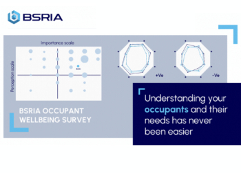
Occupant satisfaction and wellbeing tool inc. physical environment, indoor facilities, functionality and accessibility.
Preserving, waterproofing and decorating buildings.

Many resources for visitors aswell as new features for members.
Using technology to empower communities

The Community data platform; capturing the DNA of a place and fostering participation, for better design.
Heat pump and wind turbine sound calculations for PDRs

MCS publish updated sound calculation standards for permitted development installations.
Homes England creates largest housing-led site in the North

Successful, 34 hectare land acquisition with the residential allocation now completed.
Scottish apprenticeship training proposals

General support although better accountability and transparency is sought.
The history of building regulations

A story of belated action in response to crisis.
Moisture, fire safety and emerging trends in living walls

How wet is your wall?

Current policy explained and newly published consultation by the UK and Welsh Governments.

British architecture 1919–39. Book review.

Conservation of listed prefabs in Moseley.

Energy industry calls for urgent reform.