The history of the dimensions and design of roads, streets and carriageways
The dimensions and design of roads, streets and carriageways has been shaped by public health, movement, aesthetics, mathematics, legal requirements and much else.

|

|
| Elborough Street, Wandsworth, London, in around 1900. | Elborough Street in around 2000, full of parked cars. |
Hugh Davies, author of books such as ‘Roads in Roman Britain’ and ‘From Trackways to Motorways: 5,000 years of highway history’, took the view that, on the whole, people of the past created the roads that they needed. But what was needed in the past is not necessarily what is needed today. There are highways and boundaries that were established hundreds, if not thousands, of years ago. The routes of Roman roads still form parts of the A and B road network, and the influence of Roman decisions extends to towns today. In Kent, roughly 20 per cent of current high streets are on the line of former Roman roads, or streets within former Roman towns. Davies suggested that 6.5 metres, 22 pedes or around 21 feet was the average width of nearly 500 principal Roman roads that he examined.
Perhaps the bulk of the highway network is medieval in origin. As to dimensions, we have the width of bridges, town gates and the doorways of medieval barns to give an indication of the maximum size of wagons and their loads. There are accounts of laws laid down to protect and preserve rights of way. The Leges Henrici Primi (Laws of Henry I), written between 1114 and 1118, specify minimum widths for the via Regia in order to prevent encroachment. The requirement is that the way should be wide enough for two waggons (duo carri) to pass each other, for two ox-drivers to touch the tips of their goads held across the way at full length; and for 16 armed knights to ride side by side (xvi milites possint equitare de latere armati). But we are left in confusion. Two wagons might require a width of 20 feet, but 16 mounted knights as much as 80 feet. It is unclear whether this was ever enforced.
‘Designing out crime’ is evident in the Statute of Winchester 1285, in which the King commanded that in areas of forest or heath a 200 foot strip (deus centz pez) either side of the way was to be kept clear of vegetation by the landholder. There are said to be marks on the landscape left in parts of England to this day.
Edward I was a prolific promoter of new towns. At new Winchelsea the surveyors managed to lay out commendably straight streets nearly half a mile in length. There is a 1-degree variance from a perfect 90 degree grid on the first east-west street and 3 degrees on the second: a cumulative error of around 10 metres at the edge of the grid. Rental records for Winchelsea from 1292 give the size of plots and rents paid down to ¼ virga, a virga being 1/160th of an acre. In 1297 Edward I held a Colloquium in Harwich, which may well be the first recorded town planning conference, to obtain advice on how best to create the streets, buildings and defences of Berwick, that had been captured from the Scots the previous year.
Winchelsea is unusual in the uniformity of its grid. In other medieval towns, while there may have been standard plot boundaries relating to particular periods, the streets tend to wander, even if they may have been straight when first lined out. Most market streets taper at either end, making the quest for evidence of standard street widths difficult, if not futile.
With the 16th century began a period of great advances in science and surveying methods and equipment. The mathematician Leonard Digges published ‘Tectonicum’ in 1556, explaining the exact measuring and speedie (sic) reckoning of all manner of land, squares, stone and steeples. In Edinburgh in 1614 John Napier published a set of logarithms. Triangulation was developed in 1615 in Holland, and in 1620 the chain arrived on the surveying scene, devised by Edmund Gunter and equal to 22 yards or four rods.
‘The Scot’s Gardner’ by John Reid, published in 1684, advises on the laying out of avenues and walks, and the spacing of avenue trees. It contains instructions on the use of logarithms to work out land areas and of trigonometry to assist with laying out geometric shapes for groves, and the like. Reid lists the units of measurement in use: in Scotland, the Ell (37 inches) and the fall, in comparison with foot and rod in England. Even before the book had been published, Reid had left for the American colonies, where new settlements and towns were being created.
The 1730 plan for Savannah, Georgia, designed under James Oglethorpe to reflect the principles of the Enlightenment, was created to standard widths: 75 feet for main streets, half this for secondary streets, and one quarter this for lanes. The system produces strange widths of 37 feet 6 inches and 22 feet 6 inches, but these make sense if the driving force is mathematical subdivision or, as has been suggested, if it reflects the cubit as the underlying unit of measurement (22½ feet being 30 cubits, and 75 feet 100 cubits).
Back in Britain, in 1749 an Act of Parliament was passed to establish Maryport (or Ellenfoot, as it was known then), a new town laid out on a grid. The plan includes a square, and rectilinear blocks of land, each of approximately two acres, and streets of 36 feet wide. Today the streets have 24-foot carriageways and six-foot footways on either side. It can not be ascertained whether the footways were present from the outset, but these are dimensions that were carried forward in the 1877 Model Byelaws, and 24 feet (7.3 metres) remains a standard width for carriageways to this day.
The plans for Edinburgh New Town, dating from 1766/7, have a central street of 100 feet wide, outer streets and cross streets of 80 feet, and mews of 30 feet.
Public health became a driving force in the 19th century, with problems of infectious diseases such as typhus, typhoid, tuberculosis and cholera bringing life expectancy in the rapidly expanding industrial towns to below 30 years. The notion that such diseases spread by bad air, expressed as the Miasma theory, persisted well into the second half of the century when germ theory gained acceptance, and epidemiological evidence demonstrated that cholera was waterborne. The response, albeit slow, along with organised water supplies, sewerage systems, waste collection and street cleansing, was to prohibit narrow streets in order to increase ventilation and daylight. The Town Improvement Clauses Act 1847 required any new street intended for use as a carriage road to be at least 30 feet wide, and if not a carriage road, at least 20 feet wide. The Model Byelaws issued from 1877 onwards by the Local Government Management Board under powers conferred by the Public Health Act 1875, as well as setting out requirements for buildings, such as minimum window area and specification of foundations, set requirements for new streets. They stated: ‘Every person who shall lay out a new street which shall be intended for use as a carriage-road shall so lay out such street that the width thereof shall be 36 feet at the least.’
Other requirements were that the carriageway should be 24 feet at least, that a footway be provided on each side of the street of a width not less than 1/6th the width of the street, that the kerb be between 3 and 7 inches high and that the footway should have a fall of no more than 1 in 24. Streets that were not intended as carriage streets, and that were less than 100 feet long, could be 24 feet wide. Subsequent modifications in the byelaws set widths of 16 and 13 feet for back streets. These were provided so that ash and privy waste could be removed from houses without needing to be carried through the house.
At least two publishers produced guidance on the byelaws. ‘Knight’s Annotated Model Bylaws’, which provides commentary on changes, practical experience and precedents in the common law, explains that: ‘The width (24 feet) prescribed for the carriage-way of a new street is requisite in order to allow sufficient space for three ordinary vehicles, one standing on each side, with adequate space between them to allow another vehicle to be easily driven past.’
The photographs of Elborough Street in South London, taken around 100 years apart, illustrate this point. The most recent photograph shows both sides of the street completely occupied with ‘ordinary vehicles’ and ‘sufficient space to allow another vehicle to be easily driven past’ (provided that there is nothing coming in the opposite direction). Elborough Street was created under the London Building Act 1894, which required streets to be a minimum of 40 feet in width, but the 24 foot carriageway width remained standard.
In Scotland there was a series of Borough Police Acts. That of 1892 set out minimum widths, and required that the heights of dwelling houses be no more than 1¼ the width of the street, in order to improve ventilation and daylight.
The byelaw system continued well into the 20th century, although not without protest. In 1901, ‘Country Life’ ran a campaign against the ‘oppressive byelaws’, but it seems one of the motives was a desire by landowners to avoid the increased costs of building houses that complied. There was pressure to improve living conditions, from advocates such as Ebenezer Howard, and elsewhere. During the attempts by the British Army to recruit young males for service in the Boer War 1899–1901, one third of volunteers were found unfit for military service. The poor physical condition of the population became a matter of grave strategic concern, and there were subsequent moves to improve diet and reduce overcrowding.
Although the model byelaws did not require grid patterns or uniformity, grids and uniformity were what builders often provided. A paper in the proceedings of the Institution of Municipal Engineers commented that the uniformity of the streets designed to the model byelaws might appeal to the eye of some, but to the eye of the artist gave rise to feelings of nausea. Abandoning the rigid grid, a style of street layout developed in the 1920s and 30s which might be called, for want of a better term, ‘municipal geometric’, featuring crescents, axes, symmetry and concentric circles. The view from the air is impressive, but the effect on the ground is inconsequential. It requires strong architecture to carry off a crescent. The effect is lost if the buildings are two-storey, semi-detached houses.
In the late 1920s and thereafter focus turned increasingly to designing for motor vehicles. Influences included the autobahn system in Germany, highway engineering practice in North America and railway engineering practice, including the use of superelevation on bends and transition curves. The Ministry of War Transport’s ‘Roads in Built-up Areas’, published in 1946, addressed the problem of traffic growth, the efficient movement of traffic, and the creation of arterial and radial roads to achieve this. It avoided making recommendations about development roads ‘ie of roads the primary function of which is to afford frontage access to land or buildings,’ stating that ‘the standards to be observed on such roads are governed by byelaws and town planning requirements.’ The manual provided numerous cross-sections for these main roads, which came to be known as ‘distributor roads’.
The post-war new towns moved away from the standards of model byelaws, introducing carriageways that were substantially narrower than before, and a move towards low-density open planning. The government published recommended dimensions in ‘Roads in Urban Areas (1966) and Design Bulletin 32, Residential Roads and Footpaths – Layout Considerations’ (1977). Highway authorities used street design standards that reflected this guidance.
In the 1990s pioneering developments such as Poundbury moved away from vehicle-centric street design to focus on quality of place. A new era in street design was formally ushered in with the publication in 2007 of ‘Manual for Streets’, which established a user hierarchy with pedestrians and cyclists at the top, and private motor vehicles at the bottom, and recognition of the need to balance movement and place. Currently few highway authorities have updated their street design standards to reflect ‘Manual for Streets’. The standards in use are metric versions of those that are half a century old and, in the case of the 24-foot, 7.3-metre carriageway, a quarter of a millennium. The current version of the Design Manual for Roads and Bridges, which provides standards that are required to be used on trunk roads and motorways, also provides a 24-foot, 7.3 metre standard.
In 2020 Local Transport Note 01/20 ‘Cycle Infrastructure Design’ condemned the 7.3 metre (24 foot) carriageway as being unsuitable for cycling in mixed traffic: the width permits motorists to squeeze past the cyclist without leaving any distance for their safety margin or comfort.
We have inherited roads, streets and design standards that were created by past generations for a wide range of reasons, including the driving of herds of cattle, the prevention of crime, the prevention of disease (based on theories circulating at the time), the accommodation of fast-moving motor vehicles, the provision of better living environments and various ideas about aesthetics.
But the needs of the present and the future are not always the same as those of the past. We have problems and challenges of our own, ranging from enabling active lifestyles, and combating obesity and its attendant health problems, restoring to children the freedom of movement enjoyed by their great grandparents, through to eliminating road deaths and serious injuries, and achieving zero-carbon. It is important that we do not blindly copy what was done in the past, but learn from it.
Acknowledgements
Thanks to Rob Cowan, Colin Davis, David Harrison and Graham Smith for many enlightening discussions over the years about the history and future of highways.
This article originally appeared as ‘The march of the 24-foot carriageway’ in Context 167, published by the Institute of Historic Building Conservation (IHBC) in March 2021. It was written by Robert Huxford, director of the Urban Design Group.
--Institute of Historic Building Conservation
Related articles on Designing Buildings Wiki
- Conservation.
- Heritage.
- Highways.
- IHBC articles.
- Institute of Historic Building Conservation.
- Manual of Contract Documents for Highway Works.
- Overview of the road development process.
- Pavement.
- Public Health Act 1875.
- Road construction.
- The conservation of historic transport infrastructure.
- Transport design and health.
- Types of road and street.
IHBC NewsBlog
Latest IHBC Issue of Context features Roofing
Articles range from slate to pitched roofs, and carbon impact to solar generation to roofscapes.
Three reasons not to demolish Edinburgh’s Argyle House
Should 'Edinburgh's ugliest building' be saved?
IHBC’s 2025 Parliamentary Briefing...from Crafts in Crisis to Rubbish Retrofit
IHBC launches research-led ‘5 Commitments to Help Heritage Skills in Conservation’
How RDSAP 10.2 impacts EPC assessments in traditional buildings
Energy performance certificates (EPCs) tell us how energy efficient our buildings are, but the way these certificates are generated has changed.
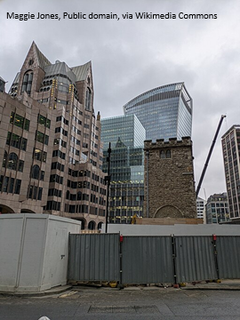
700-year-old church tower suspended 45ft
The London church is part of a 'never seen before feat of engineering'.
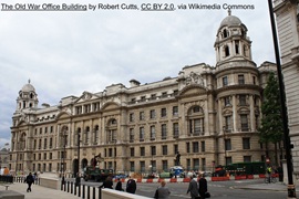
The historic Old War Office (OWO) has undergone a remarkable transformation
The Grade II* listed neo-Baroque landmark in central London is an example of adaptive reuse in architecture, where heritage meets modern sophistication.
West Midlands Heritage Careers Fair 2025
Join the West Midlands Historic Buildings Trust on 13 October 2025, from 10.00am.
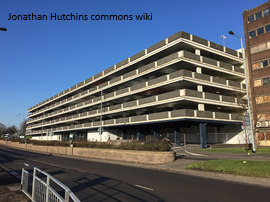
Former carpark and shopping centre to be transformed into new homes
Transformation to be a UK first.
Canada is losing its churches…
Can communities afford to let that happen?
131 derelict buildings recorded in Dublin city
It has increased 80% in the past four years.


