


Boundaries to land and property

A boundary is a line that divides one area from another. It may also be called a border and defines the extent of one or more areas that are adjacent or in close proximity.
Boundaries can be defined physically by coastlines, rivers, roads, walls, fences and lines painted on the ground, or they can have no manifestation other than on maps, plans, charts and legal documentation. Boundaries between counties, administrative regions and nation states often appear only as lines on maps.
Boundaries are often the subject of disputes and may have perimeter security to prevent unauthorised access.
Title deed drawings tend to show which side of the boundary owns any physical structure such as a fence, using a ‘T’ symbol. Title deeds may also include agreements about ownership of, or responsibility for, boundaries, although these do not generally give any great detail, and are not always clear or accurate. For more information see: Responsibility for boundary features.
Construction sites often have strictly-defined boundaries comprising fences, hoardings and gates. These not only deter thieves and intruders, but also to protect the public from inadvertently straying into a potentially dangerous area.
The Construction (Design and Management) Regulations (the CDM Regulations) require the prevention of access by unauthorised persons to construction sites and that ‘… where necessary in the interests of health and safety, a construction site must, so far as is reasonably practicable, and in accordance with the level of risk posed, comply with either or both of the following; have its perimeter identified by suitable signs and be arranged so that its extent is readily identifiable; or be fenced off.’
Buildings may be designed to extend right up to boundary lines or be limited by building regulations to be sited a minimum distance away. Where buildings adjoin one another, works to the party structure are controlled by the Party Wall Act.
NB The Scottish Building Standards, Part I. Technical Handbook – Domestic, Appendix A Defined Terms, suggests that:
'Boundary means a boundary between land on which the building is situated and land in different occupation, so however that:
- in relation to any road , whether public or private, public access way or public right of way, river, stream, canal, loch, pond, common land or a public open space it should be taken to mean the centre line thereof; and
- the sea and its foreshore should not be regarded as land in different occupation.'
NB Land measurement for planning and development purposes, Guidance Note, Global 1st edition, Published by the Royal Institution of Chartered Surveyors (RICS) in May 2021, suggests that a boundary is : ‘The edge of a title area using either of the following methods.’
- ‘Fixed boundary method: fixed boundaries are a key feature of cadastral systems. They are usually single points marked on the ground with stones, posts or metal, enabling the linear boundary between them to be determined. The type of demarcation is stated in the technical description of the cadastral survey. Coordinates, distances, bearings and areas are noted on the cadastral survey plan and mirrored on the cadastral index map.’
- ‘Determined boundary method: determined boundaries are a feature of land registration in the UK and some British Commonwealth countries, and are where boundaries identified under the ‘general boundaries’ principle are established on the ground and recorded. For example, in England and Wales the requirement is to record a boundary’s position to a precision of +/- 10mm. The determined boundary should be mapped relative to surrounding ‘hard’ detail (any feature made of brick, stone or concrete that is expected to endure) to a high level of accuracy that is certified by a chartered land surveyor. The intention is that another chartered land surveyor would be able to relocate the boundary. A determined boundary should be agreed between the neighbouring landowners before it is recorded in the land register.’
See also: General boundaries.
NB Approved document S, Infrastructure for the charging of electric vehicles, published in 2021 by HM Government, defines a boundary as: ‘The boundary of the land and/or buildings belonging to and under the control of the building owner.’
It defines the site boundary as: ‘The boundary of the land in relation to a building, in respect of which building work is being carried out, means the boundary of the land, upon which that building is situated, that is controlled or owned by the same person who owns:
- ‘that building, or
- in the case of the erection of a new building, the land upon which building work is being carried out.’
International Land Measurement Standard: Due Diligence for Land and Real Property Surveying, 1st edition, published by the International Land Measurement Standard Coalition in May 2019, defines a boundary as: ‘A line that marks the limits of an area. Boundaries can be a Physical Boundaries and Legal Boundaries, which are not all coincident and take many forms. This includes straight or curvilinear surfaces between known coordinated points or Physical Boundaries based on physical features.’
See also:
[edit] Related articles on Designing Buildings
Featured articles and news
Costs and insolvencies mount for SMEs, despite growth

Construction sector under insolvency and wage bill pressure in part linked to National Insurance, says report.
The place for vitrified clay pipes in modern infrastructure
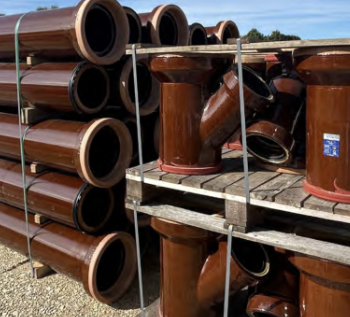
Why vitrified clay pipes are reclaiming their role in built projects.

Research by construction PR consultancy LMC published.
Roles and responsibilities of domestic clients

ACA Safety in Construction guide for domestic clients.
Fire door compliance in UK commercial buildings
![]()
Architect and manufacturer gives their low down.
Plumbing and heating for sustainability in new properties

Technical Engineer runs through changes in regulations, innovations in materials, and product systems.
Awareness of the Carbon Border Adjustment Mechanism
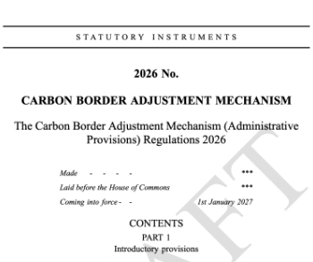
What CBAM is and what to do about it.
The new towns and strategic environmental assessments
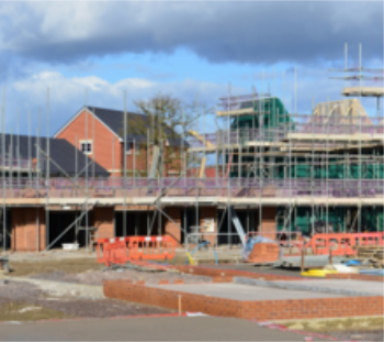
12 locations of the New Towns Taskforce reduced to 7 within the new towns draft programme and open consultation.
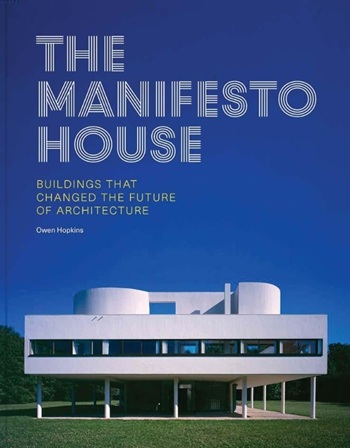
Buildings that changed the future of architecture. Book review.
The Sustainability Pathfinder© Handbook
Built environment agency launches free Pathfinder© tool to help businesses progress sustainability strategies.

Government outcome to the late payment consultation, ECA reacts.
IHBC 2025 Gus Astley Student Award winners
![]()
Work on the role of hewing in UK historic conservation a win for Jack Parker of Oxford Brookes University.
Future Homes Building Standards and plug-in solar
Parts F and L amendments, the availability of solar panels and industry responses.
How later living housing can help solve the housing crisis

Unlocking homes, unlocking lives.
Preparing safety case reports for HRBs under the BSA
A new practical guide to preparing structural inputs for safety cases and safety case reports published by IStructE.
Male construction workers and prostate cancer

CIOB and Prostate Cancer UK encourage awareness of prostate cancer risks, and what to do about it.
Comments
[edit] To make a comment about this article, or to suggest changes, click 'Add a comment' above. Separate your comments from any existing comments by inserting a horizontal line.