


Hadrian's Wall from end to end
There may be no better way to get a sense of the wall’s history than to run the 135-kilometre-long footpath, part of the National Trail network, that follows its length.

|
| Looking down on to Milecastle 39 (Castle Nick). |
Contents |
Introduction
Hadrian’s Wall is the UK’s most iconic Roman monument. Crossing the wild landscape of northern England, its building is a feat that has inspired the imagination for centuries and it is now a Unesco world heritage site. Construction began in around 122 AD, stretching across 80 Roman miles (73 modern miles), from the River Tyne at Wallsend, Newcastle, to the Cumbrian coast at Bowness on Solway, west of Carlisle.
The wall was designed with milecastles every Roman mile and turrets spaced every third of a mile in between, with forts added at regular intervals soon after. Possibly it was rendered or limewashed, a dazzling bright white symbol of Roman power cutting through the territories of the native British tribes. Following it to the south is a long, double bank and ditch, known as the Vallum, and to the north is a large ditch. Milecastles and forts were designed with gateways to both the south and north, controlling access through the wall and surrounding landscape. Nineteen centuries after it was built, much is unknown about the wall’s design, function and the people who occupied it. Used by the Romans for nearly 300 years, it was repaired, altered and rebuilt many times. It was garrisoned by soldiers from across the empire and was finally abandoned by the Romans in 411 AD, when they left Britannia.
Day 1, Wallsend to Heddon-on-the-Wall
In a moment of madness, I set myself the challenge of running the 135-kilometre-long footpath, part of the National Trail network, which follows the length of the wall. So it was that early on a Sunday morning, I found myself standing in the car park at Segedunum. Located at what is now known as Wallsend, it was once a bustling fort, guarding the eastern end of the wall at its junction with the River Tyne. Today, it is home to a museum and it is one of the most deprived areas of the country.
From here the path follows a former railway towards Newcastle city centre before dropping down to the river. A quick look at an historic map shows the industry that has been lost in the area: shipyards, docks, wharves, and works of all shapes and sizes. Through Newcastle city centre the trail follows the quayside rather than the wall itself, which lies to the north. This leads me to contemplate the wall’s regenerative potential. Twenty years after the trail’s creation, it is now perhaps time to create a second path, celebrating the actual route of the wall.
Wallsend, at the start of my journey, is the first of many places I will pass through that take their name from the wall. I end the day at another: Heddon-on-the-Wall, the point at which the National Trail and the wall converge. I cannot help but reflect on the differences in the lives of Heddon’s residents, with its luxury golf club and attractive stone-built houses, compared to the deprived communities I have passed through in Newcastle. The wall is part of Heddon’s success story; it should be possible for the same to be true elsewhere.
Day 2, Heddon to Chollerford
A couple of weeks later I am back at Heddon and at my first freestanding section of wall, approximately 100 metres long. I am impressed. Constructed of regular stone blocks to each face and a rubble core, it is chunky and solid looking. The wall is followed by the Military Road, built by General Wade in the 1750s to help deal with the Jacobite uprisings. Its construction was the single most destructive act known to have happened to the wall, which was used for the road’s foundations. The path also feels blighted by traffic. Unexpectedly, after some miles, the road diverges slightly away from the wall and the Vallum comes into sight, with views stretching for miles to the south. There is a real sense of history that stops me in my tracks. It’s glorious.
I pass Planetrees, where more wall stands proudly exposed. Here a change in the wall’s construction is visible, as it was reduced in width. If you were walking along the top of the wall, passing other people, this difference would be noticeable. Why this change occurred is not known, although a narrower wall requires less material and would be quicker to construct. As I come in sight of the River Tyne, I visit the remains of the Roman bridge abutments, large cutwaters that appear amazingly modern. Lewis holes are visible in many, a reminder of how little many traditional skills have changed over millennia.
Day 3, Chollerford to Housesteads
I start by passing Chesters Fort and museum, just to the north of the River Tyne. Soon the trail enters the Northumberland National Park. As the landscape becomes wilder, Black Carts Turret comes into view where, again, the decision to narrow the construction of the wall is clearly visible. Continuing onwards and uphill, I reach the remains of the fort of Brocolitia, or Carrawburgh as it is known today. It offers a very different experience to the better-known forts, such as Chesters. While the massive platform of the fort is visible and looms over the path, there is no visitor centre or exposed footings of buildings. Covered with long grass, it is a bleak and intimidating site.
Leaving Carrawburgh, I meet a group of volunteers carrying out conservation work to a damaged drystone wall. It is the eternal dichotomy: tourists unwittingly knock down the field boundaries and wear away the paths. It is important for people to visit but, in so doing, they damage the very thing that they are here to see.
As the landscape becomes wilder, I pass more regular stretches of visible wall. Before I know it, I am at my final stop for the day: Housesteads Fort, the most iconic and dramatically located of the wall forts. Standing at the north of the site, you can see the wall snaking off away to the east and it is easy to imagine it as a frontier, with civilisation on one side and barbarianism on the other. In reality this was likely never the case; while the wall may have been a symbolic frontier, the Romans were highly active beyond it.
Day 4: Housesteads to Birdoswald
Back at the wall, despite the fact that it is raining, I am really looking forward to my route today. It passes through some of the most spectacular scenery on the whole trail. The wall ascends and descends in a lurching series of small peaks and troughs, known as gaps. Many of these have names, the best known being Sycamore Gap. I am fortunate; for once no one else is around. I make the most of it, taking photographs from all angles. I am also doubly fortunate as less than a week later the tree has been brutally chopped down.
The peaks give excellent views both to each side and down on to the wall, with its milecastles and turrets. The wall follows the top of the Whin Sill, a dramatic, cliff-like outcrop of Dolerite rock, and I soon pass Winshields, the highest point of the wall at 375 metres above sea level. Dropping down, I cross the River Irthing. Intriguingly, the original wall west of the Irthing was of a fundamentally different construction to that to the east, being built of turf. This was subsequently replaced in stone on a slightly different alignment, which here survives impressively.
At last I arrive at Birdoswald. I walk round the remains of the fort, particularly admiring the views to the south. I am used to thinking of the wall as protecting the civilised south from the barbarian north. In fact, for much of its length, the views to the south are at least as good as the views to the north. Perhaps the Romans were watching their backs as much as looking for enemies attacking from the north.
Day 5, Birdoswald to Carlisle
I start by following the stone wall west from Birdoswald before heading slightly south to join the turf wall. The image of Hadrian’s Wall being built of stone is so strong that it is hard to comprehend that a grassy mound may have been a viable fortification. Arguably, perhaps it was not, hence it was replaced in stone. Why this section of the wall was built in turf in the first place is unknown. Perhaps there was a scarcity of materials or perhaps speed was of the essence. The stone wall is undeniably more visually impressive but I enjoy the challenge of trying to trace the turf wall in the landscape.
At Haytongate I reach the point where the geology changes from limestone to red sandstone. This is visible in the architecture that I pass, although there is very little to see by way of wall. At Dovecote Bridge, the wall was previously excavated and visible, but it was reburied to protect the soft red sandstone from deteriorating in the British weather. Passing through Walton, earthworks appear and disappear. The route gets slowly more urban and diverges from the wall as it progresses into Carlisle.
I stop for the day where the path passes under the A7 and walk into Carlisle’s fascinating city centre. Standing under a large mural featuring a Roman, I am delighted to see that the wall and Stanwick Fort are used in interpretation of the town’s heritage, even though the fort has been largely lost.
Day 6, Carlisle to Bowness
It is with a mixture of sadness and relief that I find myself back at Carlisle, about to undertake the final stretch of the path. It has been spectacular and hugely enjoyable, but also unquestionably hard work. Following the River Eden, I pass out of Carlisle with the wall mostly invisible. At Burgh by Sands, after it is too late, I realise that I have passed the Fort of Aballava without noticing, as there is little to see. Burgh is a lovely village and this part of the country feels delightfully bypassed by time, almost straight from the pages of Country Life; a stark contrast to the post-industrial landscapes at the opposite end of the wall.
As I head out of Burgh, over a cattle grid, the landscape changes dramatically. It is now a huge flat and open saltmarsh, with Scotland visible in the distance. The wall disappears, presumed lost to the marsh, although it may have never existed beyond this point, with the coast providing an adequate defensive boundary. It is ethereal, otherworldly. The path just misses the fort of Drumburgh and a little further on follows the route of a railway, which once ran from Port Carlisle into Carlisle, which itself follows the route of a former canal. The canal was a particularly poor investment, being obsolete nearly as soon as it was completed, and the railway was not a success either, with Port Carlisle being overtaken by Silloth early in the 20th century. The remains of the mysterious-looking harbour are visible, just off the coast.
And just like that, running along the marshy coast, I am on the final stretch. In Bowness the end (or start) of the trail is marked by a shelter framing views over the coast, where I have my obligatory picture taken. I wander over to see the fort of Maia, but it has been largely lost. It must be possible to make more of the forts between Bowness and Carlisle, but I also like the pleasing contrast to the ‘exit via the gift shop’ style of heritage offered in so many other places.
I know this will not be the last time I see the wall. I will be back, eager to see it through the seasons. And there is more: the National Trail path ends in Bowness but the fortifications continue. There are another 20 Roman miles of them down the Cumbrian coast to Maryport. While there is no curtain wall for this stretch, it feels like the National Trail should be extended, following the full length of the world heritage site, bringing its educational and economic opportunities. Similarly, at the eastern end it could be extended from Wallsend to South Shields and the fort of Arbeia.
This article originally appeared in the Institute of Historic Building Conservation’s (IHBC’s) Context 179, published in March 2024. It was written by Zinnie Denby-Mann, a historic building professional who is based in Northumberland and works across the north of England.
--Institute of Historic Building Conservation
Related articles on Designing Buildings
IHBC NewsBlog
200th Anniversary Celebration of the Modern Railway Planned
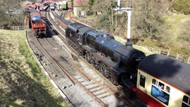
The Stockton & Darlington Railway opened on September 27, 1825.
Competence Framework Launched for Sustainability in the Built Environment

The Construction Industry Council (CIC) and the Edge have jointly published the framework.
Historic England Launches Wellbeing Strategy for Heritage
Whether through visiting, volunteering, learning or creative practice, engaging with heritage can strengthen confidence, resilience, hope and social connections.
National Trust for Canada’s Review of 2024
Great Saves & Worst Losses Highlighted
IHBC's SelfStarter Website Undergoes Refresh

New updates and resources for emerging conservation professionals.
‘Behind the Scenes’ podcast on St. Pauls Cathedral Published
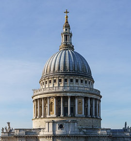
Experience the inside track on one of the world’s best known places of worship and visitor attractions.
National Audit Office (NAO) says Government building maintenance backlog is at least £49 billion

The public spending watchdog will need to consider the best way to manage its assets to bring property condition to a satisfactory level.
IHBC Publishes C182 focused on Heating and Ventilation
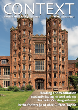
The latest issue of Context explores sustainable heating for listed buildings and more.
Notre-Dame Cathedral of Paris reopening: 7-8 December

The reopening is in time for Christmas 2025.
Stirling Prize-winning Salford building to be demolished
The Centenary Building will be bulldozed as part of the wider £2.5bn Crescent regeneration project.