


Wind rose
A wind rose is a graphical representation of the wind's speed and direction at a specific location over a given period, typically displayed in a circular format. It is a useful tool used in meteorology, climatology, and environmental studies, building design, urban planning, site selection for wind energy projects and so on to visualize wind patterns at a particular site.
The wind rose is divided into segments, each representing a cardinal or intermediate direction (e.g., north, northeast, east, southeast, south, southwest, west, northwest). The length of each segment indicates the frequency or percentage of time the wind blows from that direction, while a colour or shading can be used to represent the wind's average speed or intensity from that direction.
The wind rose's origin can be attributed to the ancient Greeks and Romans, who began documenting wind directions to assist with maritime exploration and trade routes. However, the concept of wind direction predates this, with evidence suggesting that early humans observed wind patterns for practical purposes such as hunting, gathering, and navigation.
During the Middle Ages, the use of wind roses became more common in the Mediterranean region. Arab navigators and cartographers further developed the wind rose, incorporating it into portolan charts—nautical maps used for sailing in the Mediterranean and Black Sea. These charts depicted coastal landmarks, distances, and, crucially, wind directions, allowing sailors to plan their routes more effectively.
In the 14th and 15th centuries, wind roses played a significant role in European exploration. The Age of Exploration saw the rise of global sea voyages, and mariners relied heavily on wind roses for navigation. Explorers like Christopher Columbus and Vasco da Gama used wind roses to plot their courses and determine prevailing winds, contributing to the expansion of maritime exploration and trade routes.
Some early wind roses were relatively simple, using only a few cardinal directions, while others became more detailed and sophisticated. As cartography and meteorology advanced, wind roses were integrated into maps and weather charts, providing valuable information for understanding local weather patterns and climate.
Today, wind roses are still widely used in meteorology, climatology, and environmental studies. With advancements in technology and the availability of real-time weather data, wind roses have become even more accurate and accessible.
Wind roses play crucial roles in building design and the design of other built structures:
- Wind roses aid in choosing the most suitable location for a building or development. Wind data can help identify sites with favourable wind conditions that can promote natural ventilation, reduce indoor temperature fluctuations, and enhance thermal comfort.
- Wind roses can also be used to influence decisions about orientation so as to optimise performance and reduce exposure.
- In regions prone to strong winds or extreme weather events, wind roses help design buildings that can withstand these forces. By understanding the dominant wind directions and intensities, designers can incorporate features like windbreaks, aerodynamic shapes, and structural reinforcements to ensure the building's stability and safety.
- Wind roses aid in designing effective natural ventilation strategies. For example, designers can position windows, louvers, and openings strategically to capture prevailing winds and optimise natural ventilation. By aligning the building's orientation to maximize sun exposure and minimize exposure to prevailing winds, architects can improve indoor thermal comfort and reduce the need for artificial heating and cooling.
- Wind roses are also valuable for designing outdoor spaces such as courtyards, plazas, and terraces. Designers can arrange these spaces to offer shelter from prevailing winds, making them more comfortable for occupants and visitors.
- In some green building certification programs, such as LEED (Leadership in Energy and Environmental Design), understanding and incorporating wind data into the design process can earn points and contribute to achieving certification levels.
[edit] Related articles on Designing Buildings
Featured articles and news

Gregor Harvie argues that AI is state-sanctioned theft of IP.
Experimental AI housing target help for councils

Experimental AI could help councils meet housing targets by digitising records.
New-style degrees set for reformed ARB accreditation

Following the ARB Tomorrow's Architects competency outcomes for Architects.
BSRIA Occupant Wellbeing survey BOW
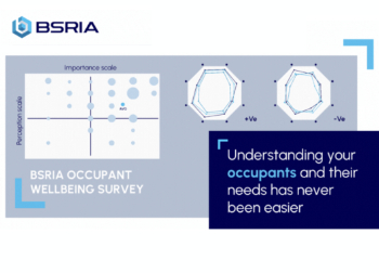
Occupant satisfaction and wellbeing tool inc. physical environment, indoor facilities, functionality and accessibility.
Preserving, waterproofing and decorating buildings.

Many resources for visitors aswell as new features for members.
Using technology to empower communities

The Community data platform; capturing the DNA of a place and fostering participation, for better design.
Heat pump and wind turbine sound calculations for PDRs
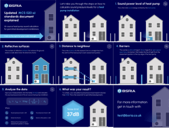
MCS publish updated sound calculation standards for permitted development installations.
Homes England creates largest housing-led site in the North

Successful, 34 hectare land acquisition with the residential allocation now completed.
Scottish apprenticeship training proposals

General support although better accountability and transparency is sought.
The history of building regulations

A story of belated action in response to crisis.
Moisture, fire safety and emerging trends in living walls

How wet is your wall?

Current policy explained and newly published consultation by the UK and Welsh Governments.

British architecture 1919–39. Book review.

Conservation of listed prefabs in Moseley.

Energy industry calls for urgent reform.

Heritage staff wellbeing at work survey.