PAS 256: Buried assets
Contents[hide] |
[edit] Introduction
In April 2017, the Institution of Civil Engineers, in collaboration with BSI and Infrastructure UK in HM Treasury, published PAS 256, a national common code of practice on buried apparatus that can be implemented across the UK.
The UK has a vast network of utility and local authority infrastructure, with over 1.5 million km of assets buried beneath highways and footways.
To repair, maintain and upgrade this, the utility industry and the Local Highways Authorities collectively undertake a total of over 3.5 million street works per annum.
In recent years, with the growing concern over the level of traffic congestion, efforts have been made to improve the administration procedures for street works and to encourage utilities to minimise their work in the street.
However, despite some progress, there remains no central repository of data for buried services and underground apparatus, nor any consistent means of sharing the required data. Utilities that hold data on their own infrastructure do so in different formats – some vector-based, some on paper drawings, some on microfiche – which makes coordination of information challenging, costly and bureaucratic.
Improving the ready availability and exchange of asset information, together with more effective and collaborative planning and coordination will lead to better planned road works resulting in significant cost savings; more effective reinstatement practices; longer pavement life; and improved quality of advance information, readily available to all who need to see it.
Ultimately, it is hoped that the new PAS can support the creation of a coordinated digital map using real world location and deliver a step change in how effective, managed data supports improved planning, co-ordination and delivery.
[edit] Who is this PAS for?
It will be used by organisations that own buried assets, those that require asset records for planning and design purposes, and those that carry out work in the vicinity of buried assets.
It will build on the existing legislation of the New Roads and Street Works Act (NRSWA) and take the next step forward from PAS 128: Specification for underground utility detection, verification and location (2014). PAS 128 set out the accuracy to which the data should be captured, the quality expected of the data and a means by which to assess and indicate the confidence that can be placed in the data.
[edit] Aims of the PAS and why it should be used
The data recommendations in the PAS will help to increase public safety, minimise delay, costs and disruption during street works and mitigate risks of damaging existing assets.
This PAS aims to provide the framework for those owning buried assets to:
- Drive towards improved accuracy when capturing and recording information.
- Share more accurate records collaboratively with those working in the vicinity of their buried assets.
- Improve the linkage between assets that are part of the critical national infrastructure with initiatives such as smart cities and BIM.
This PAS sets out a consistent, accessible data protocol to enable effective recording and sharing of the location, state, and nature of buried assets, and recommends how existing asset records should be updated, recorded and collated.
This PAS will also cover:
- The gathering of geospatial data using absolute or relative accuracy, plus associated evidence (such as photographic evidence).
- Measurable deviations from straight line installations where appropriate.
- The absolute depth of the asset.
- The number of days to record and make available the asset data, once collected.
- The sharing of collected asset data.
This article was originally published here on 11 Apr 2017 by ICE. It was written by Rabinder Phull.
--The Institution of Civil Engineers
[edit] Find out more
[edit] Related articles on Designing Buildings Wiki
- Building services engineer.
- Construction drones
- Crossrail 2.
- How to work safely on a construction site in the dark.
- Institution of Civil Engineers.
- Lighting of construction sites.
- Masterplanning.
- Mechanical ventilation.
- Printing 3D models of buildings.
- Open data - how can it aid the development of the construction industry?
- Site appraisal.
- Site information.
Featured articles and news
Gregor Harvie argues that AI is state-sanctioned theft of IP.
Experimental AI housing target help for councils
Experimental AI could help councils meet housing targets by digitising records.
New-style degrees set for reformed ARB accreditation
Following the ARB Tomorrow's Architects competency outcomes for Architects.
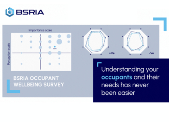
BSRIA Occupant Wellbeing survey BOW
Occupant satisfaction and wellbeing tool inc. physical environment, indoor facilities, functionality and accessibility.
Preserving, waterproofing and decorating buildings.
Many resources for visitors aswell as new features for members.
Using technology to empower communities
The Community data platform; capturing the DNA of a place and fostering participation, for better design.
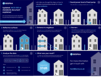
Heat pump and wind turbine sound calculations for PDRs
MCS publish updated sound calculation standards for permitted development installations.
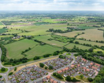
Homes England creates largest housing-led site in the North
Successful, 34 hectare land acquisition with the residential allocation now completed.
Scottish apprenticeship training proposals
General support although better accountability and transparency is sought.
The history of building regulations
A story of belated action in response to crisis.
Moisture, fire safety and emerging trends in living walls
How wet is your wall?
Current policy explained and newly published consultation by the UK and Welsh Governments.
British architecture 1919–39. Book review.
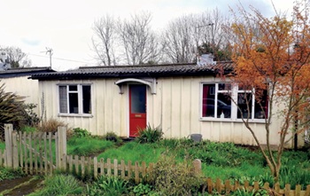
Conservation of listed prefabs in Moseley.
Energy industry calls for urgent reform.
Heritage staff wellbeing at work survey.


