


Elevate Your Projects with Advanced Drone Mapping Solutions
Drone mapping involves using unmanned aerial vehicles (UAVs) equipped with high-resolution cameras and sensors to capture detailed images and data from above. This technology provides a comprehensive overview of landscapes, structures, and infrastructure, transforming how we approach various projects. By leveraging drones, professionals can access accurate, up-to-date information with remarkable efficiency.
Contents |
[edit] Technology Behind Drone Mapping
Drone mapping technology combines advanced UAVs with sophisticated sensors and cameras. Drones are equipped with high-definition cameras that capture aerial imagery, while GPS systems ensure precise location tracking. These components work together to gather extensive data, which is then processed using specialised software to create detailed maps and 3D models.
[edit] Applications of Drone Mapping
Drone mapping finds applications across multiple sectors:
- Construction and Infrastructure: Drones provide real-time progress updates, monitor site conditions, and support planning and design processes.
- Agriculture and Environmental Monitoring: They offer insights into crop health, land usage, and environmental changes, aiding in better decision-making.
- Urban Planning and Development: Drones assist in analysing city layouts, planning new developments, and managing urban growth.
- Real Estate and Property Management: High-resolution aerial imagery enhances property listings, provides site assessments, and supports marketing efforts.
[edit] Advantages of Drone Mapping
The use of drones for mapping offers several advantages:
- High-Resolution Imagery: Drones capture detailed and clear images, allowing for accurate analysis and decision-making.
- Efficiency and Cost-Effectiveness: Drones cover large areas quickly, reducing the need for extensive ground surveys and saving time and money.
- Enhanced Data Accuracy and Precision: The integration of GPS and other sensors ensures precise data collection and mapping.
- Access to Difficult or Dangerous Areas: Drones can reach areas that are challenging or hazardous for human access, providing valuable data without risk.
[edit] Choosing the Right Drone Mapping Service
When selecting a drone mapping service, consider:
- Service Provider Expertise: Ensure the provider has experience and expertise in handling projects similar to yours.
- Equipment Quality: Check the quality of the drones and technology used to ensure accurate and reliable results.
- Project Needs: Assess your specific requirements and choose a service that can cater to those needs effectively.
[edit] Case Studies and Success Stories
Numerous projects have benefited from drone mapping:
- Construction: A large infrastructure project used drones to monitor progress and manage logistics, leading to improved efficiency and cost savings.
- Agriculture: Farmers utilised drones to monitor crop health and optimise resource use, resulting in increased yields and reduced waste.
[edit] Conclusion
Drone mapping services offer innovative solutions for capturing detailed, accurate data across various sectors. As technology advances, drone mapping will continue to enhance project planning and execution. To leverage these benefits, consider incorporating drone mapping into your projects and stay ahead of the curve in your industry.
Featured articles and news
British Architectural Sculpture 1851-1951

A rich heritage of decorative and figurative sculpture. Book review.
A programme to tackle the lack of diversity.
Independent Building Control review panel
![]()
Five members of the newly established, Grenfell Tower Inquiry recommended, panel appointed.
ECA progress on Welsh Recharging Electrical Skills Charter
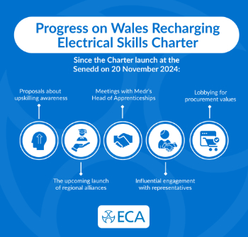
Working hard to make progress on the ‘asks’ of the Recharging Electrical Skills Charter at the Senedd in Wales.
A brief history from 1890s to 2020s.
CIOB and CORBON combine forces

To elevate professional standards in Nigeria’s construction industry.
Amendment to the GB Energy Bill welcomed by ECA

Move prevents nationally-owned energy company from investing in solar panels produced by modern slavery.

Gregor Harvie argues that AI is state-sanctioned theft of IP.

Heat pumps, vehicle chargers and heating appliances must be sold with smart functionality.
Experimental AI housing target help for councils
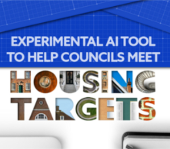
Experimental AI could help councils meet housing targets by digitising records.
New-style degrees set for reformed ARB accreditation

Following the ARB Tomorrow's Architects competency outcomes for Architects.
BSRIA Occupant Wellbeing survey BOW
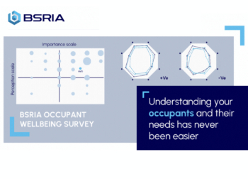
Occupant satisfaction and wellbeing tool inc. physical environment, indoor facilities, functionality and accessibility.

Preserving, waterproofing and decorating buildings.