National heat map
The National Heat Map was commissioned by the Department of Energy and Climate Change (DECC) and created by The Centre for Sustainable Energy.
The map is intended to support local low-carbon energy projects in England by providing high-resolution web-based maps of heat demand. This helps identify locations where heat distribution is most likely to be beneficial and economic. It is intended to be used as a tool for prioritising locations suitable for more detailed investigation rather than a tool for designing heat networks.
At high zoom levels the map is sufficiently detailed to allow users to identify individual buildings and groups of buildings which could benefit from heat distribution installations. However, as it is based on published sub-national energy consumption statistics rather than meter readings, once a location has been identified as having potential, it is necessary to obtain directly metered data.
In addition, point locations for combined heat and power (CHP) and power stations were mapped along with local authority and regional boundaries.
NB On 11 August 2014, the Department of Energy & Climate Change (DECC) published a high-level water source heat map for England. The map is intended to highlight opportunities for using water source heat pump technology for district heating networks. DECC suggest that they will publish a more detailed water source heat map in the winter as part of the National Heat Map.
[edit] Find out more
[edit] Related articles on Designing Buildings Wiki
- Air source heat pumps.
- Combined heat and power.
- Community energy network.
- District heating.
- Geothermal pile foundations.
- Ground energy options.
- Ground source heat pumps.
- Heat meter.
- Heat Networks Investment Project HNIP.
- Thermal labyrinths.
- Water source heat map.
- Water source heat pump.
- What can government do about district heating.
[edit] External references
Featured articles and news
The history of building regulations
A story of belated action in response to crisis.
Moisture, fire safety and emerging trends in living walls
How wet is your wall?
Current policy explained and newly published consultation by the UK and Welsh Governments.
British architecture 1919–39. Book review.
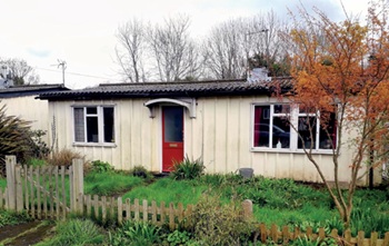
Conservation of listed prefabs in Moseley.
Energy industry calls for urgent reform.
Heritage staff wellbeing at work survey.
A five minute introduction.
50th Golden anniversary ECA Edmundson apprentice award
Showcasing the very best electrotechnical and engineering services for half a century.
Welsh government consults on HRBs and reg changes
Seeking feedback on a new regulatory regime and a broad range of issues.
CIOB Client Guide (2nd edition) March 2025
Free download covering statutory dutyholder roles under the Building Safety Act and much more.
AI and automation in 3D modelling and spatial design
Can almost half of design development tasks be automated?
Minister quizzed, as responsibility transfers to MHCLG and BSR publishes new building control guidance.
UK environmental regulations reform 2025
Amid wider new approaches to ensure regulators and regulation support growth.
The maintenance challenge of tenements.
BSRIA Statutory Compliance Inspection Checklist
BG80/2025 now significantly updated to include requirements related to important changes in legislation.


