


Ordnance survey
Ordnance Survey is the national mapping agency for Britain.
Its origins date back to the mapping of the Scottish Highlands following the rebellion in 1745. Since 1 April 2015 Ordnance Survey (OS) has operated as Ordnance Survey Ltd, owned by the Secretary of State for Business, Energy & Industrial Strategy (BEIS).
It describes its aim as ‘..to provide mapping that informs, guides and inspires. Our vision is to reveal our ever-changing landscape in extraordinary detail, giving the most comprehensive view of Britain.’
It provides location-based products such as paper maps, digital map data, online route planning and sharing services and mobile apps. It has mapped the location of every fixed physical object in Great Britain to within one metre accuracy and its team of around 300 surveyors and two aircraft produce 10,000 updates to its system every day.
Ordnance survey paper and digital maps can be useful as a basis for creating site plans, location plans and block plans for proposed developments, and for illustrating pre-development layouts for the purpose of planning applications, building regulation applications, preparing design proposals, feasibility studies and so on.
For more information go to https://www.ordnancesurvey.co.uk/
[edit] Related articles on Designing Buildings Wiki
Featured articles and news

Gregor Harvie argues that AI is state-sanctioned theft of IP.

Heat pumps, vehicle chargers and heating appliances must be sold with smart functionality.
Experimental AI housing target help for councils

Experimental AI could help councils meet housing targets by digitising records.
New-style degrees set for reformed ARB accreditation

Following the ARB Tomorrow's Architects competency outcomes for Architects.
BSRIA Occupant Wellbeing survey BOW
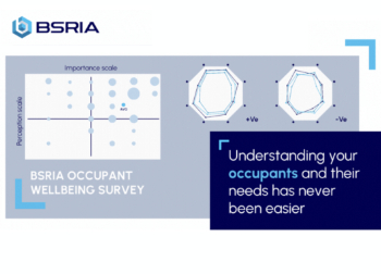
Occupant satisfaction and wellbeing tool inc. physical environment, indoor facilities, functionality and accessibility.
Preserving, waterproofing and decorating buildings.

Many resources for visitors aswell as new features for members.
Using technology to empower communities

The Community data platform; capturing the DNA of a place and fostering participation, for better design.
Heat pump and wind turbine sound calculations for PDRs

MCS publish updated sound calculation standards for permitted development installations.
Homes England creates largest housing-led site in the North

Successful, 34 hectare land acquisition with the residential allocation now completed.
Scottish apprenticeship training proposals

General support although better accountability and transparency is sought.
The history of building regulations

A story of belated action in response to crisis.
Moisture, fire safety and emerging trends in living walls

How wet is your wall?

Current policy explained and newly published consultation by the UK and Welsh Governments.

British architecture 1919–39. Book review.

Conservation of listed prefabs in Moseley.

Energy industry calls for urgent reform.
Comments