


Waterway
|
Taken from Saxon Shore way, this view over the Strait of Dover includes the French coast near Calais, which is visible in the distance. |

Contents |
[edit] Introduction
The International Levee Handbook, published by CIRIA in 2013, defines a waterway as: ‘A navigable channel.’
[edit] History
The use of waterways as a navigational tool goes back to prehistoric times. They were essential for the transport of people and goods, and the development of early civilisations depended on waterways for military purposes.
It is believed that the Ancient Egyptians were the first civilisation to use maritime vessels, followed by the Phoenicians, Greeks and Romans.
During the Industrial Revolution, artificial waterways in the United Kingdom were an essential part of the country’s commercial development. The canal network supported the growth of wealth and industry during the Victorian era and served to finance the rise of the British Empire.
[edit]
There are many different types of waterways that are navigable. This can include oceans, seas, canals, estuaries, lakes, some streams, rivers, creeks, gullies, washes and so on.
Waterways can be defined as being navigable based on a range of factors:
- Depth. Must be suitable for designated vessels.
- Width. Must have sufficient width to accommodate the beam of approved waterway traffic.
- Accessibility. Must not have obstructions or obstacles that could impede access.
- Current. The natural current of the waterway must not hinder the flow of traffic.
- Wave crest. The average height of waves must not be hazardous to vessels.
In the United States, the definition of the term 'navigable' is dictated by U.S. law. Navigable waterways are used for commercial purposes and are solely meant to transport people and goods. Their oversight is handled by the federal government which can dictate every aspect of navigable waterway usage. This includes who uses the waterways, how the waterways are used and if (and when) the waterways need to be altered.
[edit] Maritime waterways
There are maritime shipping routes (also referred to as sea lanes, sea roads, sea routes or shipping lanes) for large seagoing ships. Oceans, seas and large lakes are the most common types of maritime waterways.
Maritime waterways are generally served by seaports that are sometimes situated inland but are positioned in such a way as to make it possible for large vessels to access them.
The Strait of Dover between the UK and France is the busiest maritime waterway in the world.
[edit] Inland waterways
In 1953, The European Conference of Ministers of Transport established a classification of inland waterways that has been modified to address the development of push-towing. Inland waterways may also be referred to as inland water transport (IWT) systems.
Natural inland waterways include rivers, streams, small lakes and so on. Artificially made inland waterways include canals, locks and navigable aqueducts.
Inland waterways have some disadvantages:
- Availability. There are not numerous inland waterways around the world that are safely navigable.
- Restricted speed. Waterway transport is a slow process (compared to land or air transport). This is even slower in inland waterways.
- Navigation flexibility. Inland waterways have fixed points that are generally not subject to change. Land and air transport can usually be shifted, if necessary.
- Seasonal fluctuations. Extreme weather conditions can have a significant impact on inland waterways. Freezing conditions or droughts can render these waterways impassible.
- Safety. There may be weather related situations where crew members , passengers and goods could be at risk due to unpredictably rough conditions or cold weather.
[edit] Related articles on Designing Buildings Wiki
Featured articles and news
Costs and insolvencies mount for SMEs, despite growth

Construction sector under insolvency and wage bill pressure in part linked to National Insurance, says report.
The place for vitrified clay pipes in modern infrastructure
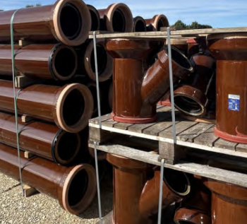
Why vitrified clay pipes are reclaiming their role in built projects.

Research by construction PR consultancy LMC published.
Roles and responsibilities of domestic clients

ACA Safety in Construction guide for domestic clients.
Fire door compliance in UK commercial buildings
![]()
Architect and manufacturer gives their low down.
Plumbing and heating for sustainability in new properties

Technical Engineer runs through changes in regulations, innovations in materials, and product systems.
Awareness of the Carbon Border Adjustment Mechanism
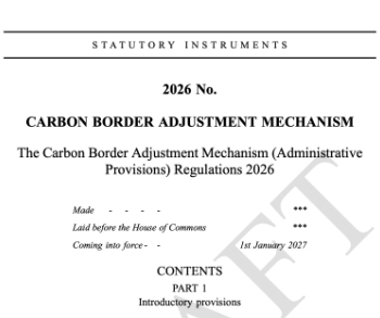
What CBAM is and what to do about it.
The new towns and strategic environmental assessments

12 locations of the New Towns Taskforce reduced to 7 within the new towns draft programme and open consultation.

Buildings that changed the future of architecture. Book review.
The Sustainability Pathfinder© Handbook
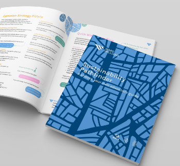
Built environment agency launches free Pathfinder© tool to help businesses progress sustainability strategies.

Government outcome to the late payment consultation, ECA reacts.
IHBC 2025 Gus Astley Student Award winners
![]()
Work on the role of hewing in UK historic conservation a win for Jack Parker of Oxford Brookes University.
Future Homes Building Standards and plug-in solar
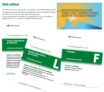
Parts F and L amendments, the availability of solar panels and industry responses.
How later living housing can help solve the housing crisis

Unlocking homes, unlocking lives.
Preparing safety case reports for HRBs under the BSA

A new practical guide to preparing structural inputs for safety cases and safety case reports published by IStructE.
Male construction workers and prostate cancer

CIOB and Prostate Cancer UK encourage awareness of prostate cancer risks, and what to do about it.