


File:Gaming the urban past.png
Size of this preview: 800 × 546 pixels
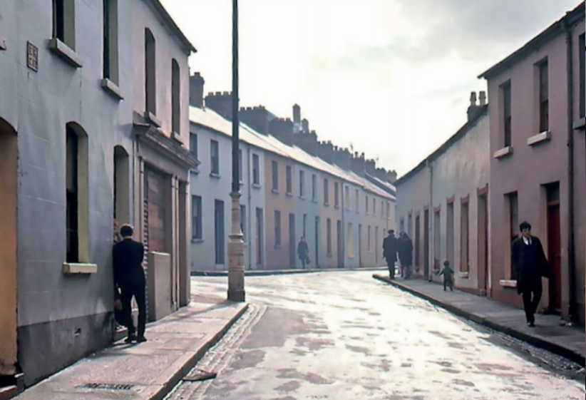
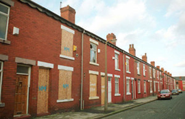
The junction of St Columbs Wells and Howard Street in around 1963. This is a typical example of the kind of terraced street that was demolished as part of the housing and infrastructure regeneration schemes of the 1960s and 1970s. Source: Gaming the urban past in Context 168, published by the Institute of Historic Building Conservation (IHBC) in June 2021, written by Adrian Grant, a historian and lecturer in policy at Ulster University. He is currently leading the AHRC-funded project Divided Pasts Design Futures, which seeks to utilise heritage more effectively in urban design and planning processes. https://ihbconline.co.uk/context/168/28/index.html
File history
Click on a date/time to view the file as it appeared at that time.
| Date/Time | Thumbnail | Dimensions | User | Comment | |
|---|---|---|---|---|---|
| current | 07:01, 12 September 2021 | | 822 × 561 (640 KB) | Designing Buildings (Talk | contribs) | (The junction of St Columb’s Wells and Howard Street in around 1963. This is a typical example of the kind of terraced street that was demolished as part of the housing and infrastructure regeneration schemes of the 1960s and 1970s. Source: ‘Gaming th) |
- Edit this file using an external application (See the setup instructions for more information)
File usage
The following page links to this file:
IHBC NewsBlog
Purcell’s guidance on RAAC for Listed Buildings in England & Wales

The guidance specifically focuses on Reinforced Autoclaved Aerated Concrete (RAAC) in listed buildings.
IHBC Membership Journal Context - Latest Issue on 'Hadrian's Wall' Published
The issue includes takes on the wall 'end-to-end' including 'the man who saved it'.
Heritage Building Retrofit Toolkit developed by City of London and Purcell
The toolkit is designed to provide clear and actionable guidance for owners, occupiers and caretakers of historic and listed buildings.
70 countries sign Declaration de Chaillot at Buildings & Climate Global Forum

The declaration is a foundational document enabling progress towards a ‘rapid, fair, and effective transition of the buildings sector’
Bookings open for IHBC Annual School 12-15 June 2024
Theme: Place and Building Care - Finance, Policy and People in Conservation Practice
Rare Sliding Canal Bridge in the UK gets a Major Update
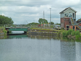
A moveable rail bridge over the Stainforth and Keadby Canal in the Midlands in England has been completely overhauled.
'Restoration and Renewal: Developing the strategic case' Published
The House of Commons Library has published the research briefing, outlining the different options for the Palace of Westminster.
Brum’s Broad Street skyscraper plans approved with unusual rule for residents
A report by a council officer says that the development would provide for a mix of accommodation in a ‘high quality, secure environment...
English Housing Survey 2022 to 2023
Initial findings from the English Housing Survey 2022 to 2023 have been published.
Audit Wales research report: Sustainable development?
A new report from Audit Wales examines how Welsh Councils are supporting repurposing and regeneration of vacant properties and brownfield sites.